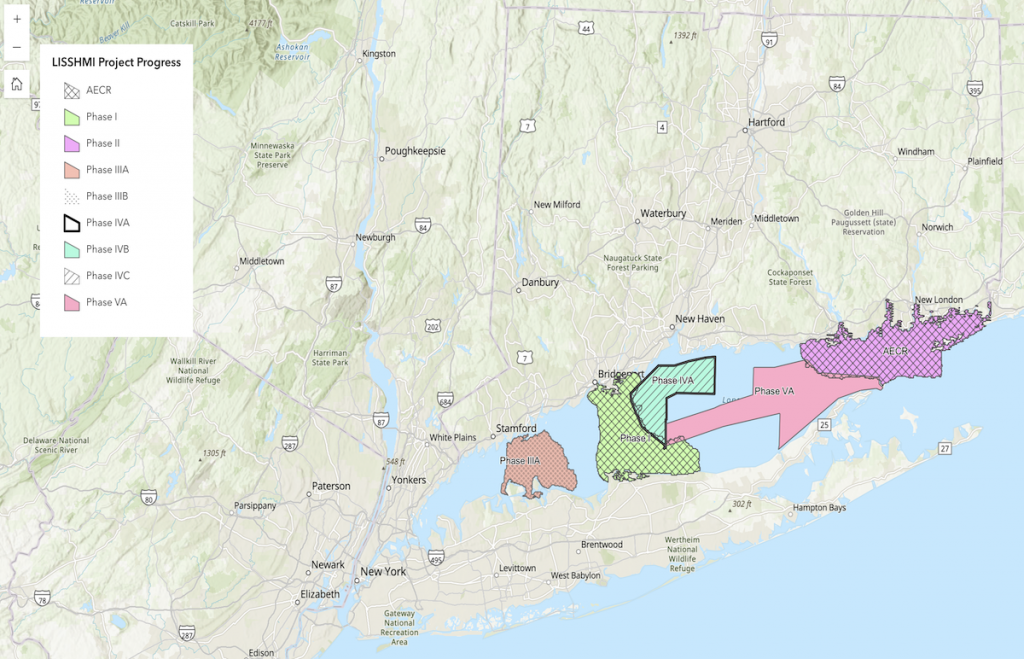
The LIS Seafloor Habitat Mapping Initiative is being conducted in phases based upon priority as identified by the process outlined below. Click on the image below to link to an interactive map showing the LIS Mapping Initiative regions, and current state of completion.
Prioritizing Where to Map
To most effectively use the Cross Sound Cable Fund, the LIS Mapping Initiative surveyed regional stakeholders to identify the highest priority areas to be mapped based upon several factors including ecological value, multiple uses, and development pressure. In addition, representatives from state, federal, academic institutions and other collaborators participated in a Spatial Prioritization Workshop (8/3-4/2011) to further identify critical management applications of the information to be produced, spatial prioritization within Long Island Sound, and key data sources and derived products needed. A detailed description of the process used to prioritize the areas to be mapped can be found here:
This process was used to identify the areas, starting with the central Sound area deemed the Phase I Pilot Area that served as an operational test-bed for a multi-year habitat mapping effort, completed in 2014. The second highest priority region, Phase 2, a large portion of eastern LIS, including Fishers Island Sound, was completed in 2021. The third priority area, Phase 3 is underway, with the majority of the fieldwork being completed.
In 2020 the LIS Mapping Initiative Steering Committee and its mapping partners were able to leverage funds available through the Long Island Sound Study’s Comprehensive Coastal Management Plan’s Enhancement Grant program to expand the work from the past 8 years and maximize the consistent collection and analysis of data to an additional area within the LIS basin. This area in the east-central basin, where no other recent acoustic surveys have been made, became the Phase 4 region. This was the first area that uncoupled the acoustic data collection from the more comprehensive characterizations, as it was recognized that newer bathymetric and backscatter maps were essential for meaningful site selection for these subsequent sampling programs.