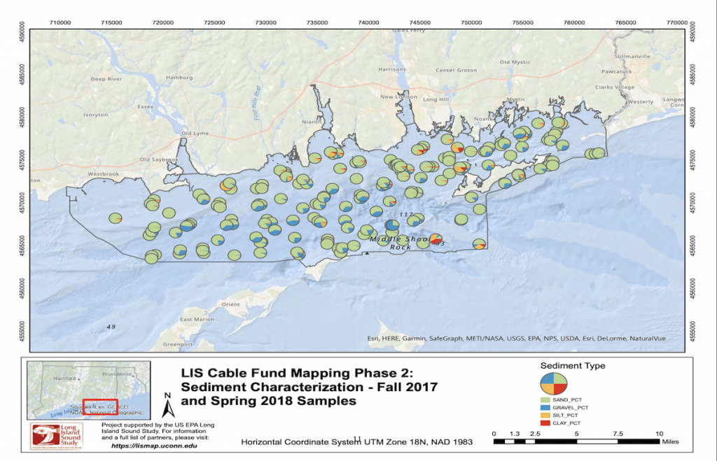
Sediment texture, which includes shape, size and three-dimensional arrangement of sediment particles, is an essential element of any seafloor habitat classification. In addition to grain size information, the total organic content distribution is of great value for the biological habitat classification since it can be an indicator of biological activity. Moreover, the sediment surface samples are also analyzed for nitrogen, metals, and matrix density each providing valuable, additional information on the nature of the seafloor.
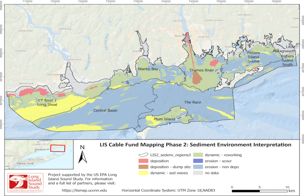
While sediment texture describes the grain size composition, the sedimentary environment describes the processes controlling the nature of a larger portion of the seafloor, such as an area where sediments are deposited, or conversely being eroded by physical forces. Knowing the distribution of these environments provides insights into the dynamics of the seafloor in LIS and, therefore, is important for identifying and understanding areas that are stable or changing.

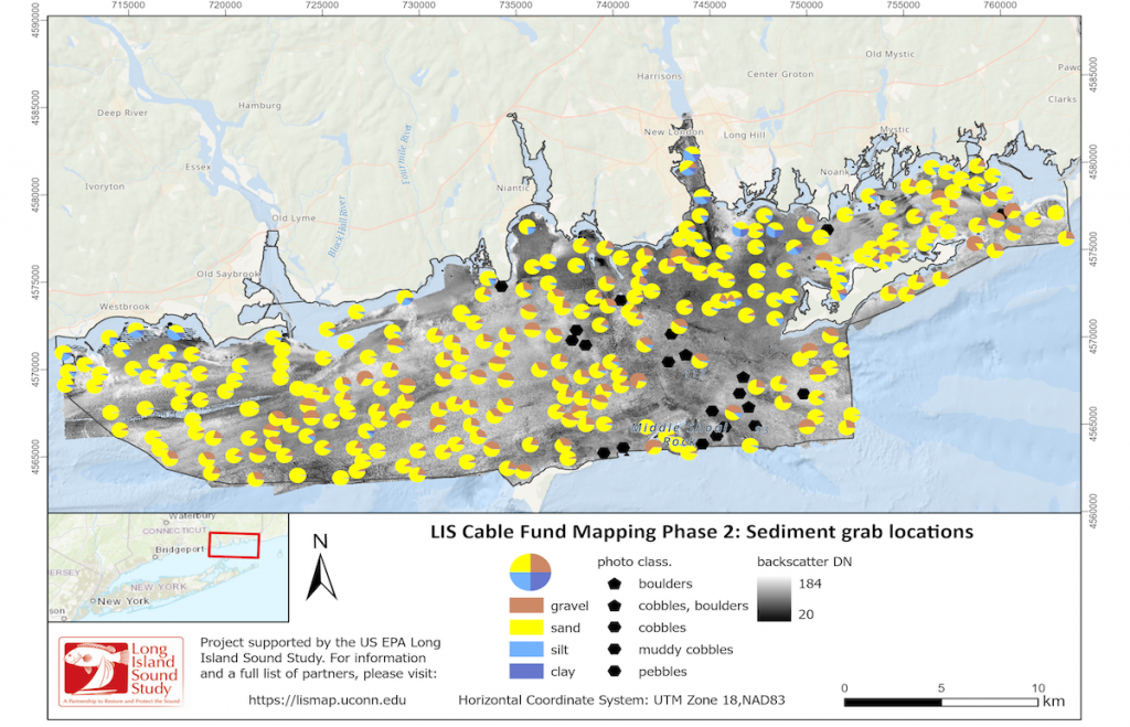
Sediment grain size & texture
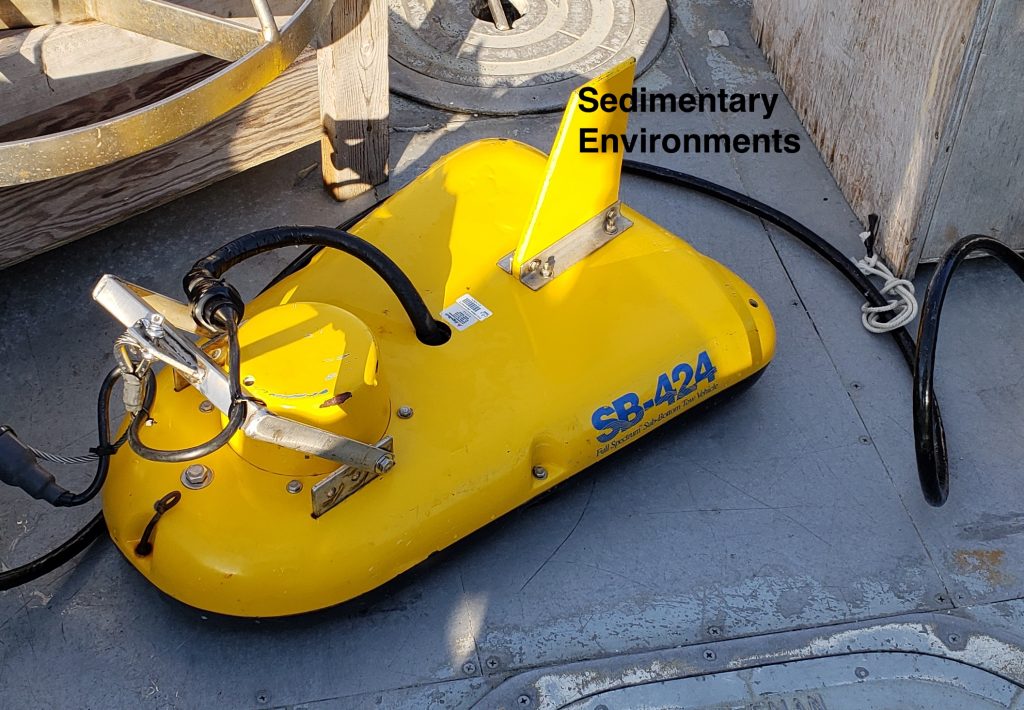
Sedimentary environments
Sediment technologies
Gravel, sand, mud and various mixtures of these major grain size classes provide very different habitats that determine which organisms can live, ie have adapted to those varying conditions. Besides its importance for habitats, the surface sediment classification is a key element for managing different resources in LIS. In fact, different bottom types can themselves be considered a valuable resource (e.g. sand). Further, sediment grain size is one of the main factors influencing the distribution of heavy metal contaminant levels.
Sediment sediment grain size has been studied in LIS for many decades because it provides the basis for other studies and management applications. There are abundant old grain size data available, but the seafloor environment is highly variable in places and data several decades old might not reflect the current conditions.
The archival data and the more recent data collected by the LIS Seafloor Habitat Mapping Initiative can be accessed through the Long Island Sound Data Navigator. The recent data is also available on the LDEO Long Island Sound Program page.
Sedimentary Environments
Not only does the assessment of sedimentary environments provide information on a larger area of the seafloor, but they also provide insights into the longer-term geological processes that are occurring over time. This is achieved by taking sediment cores, often meters deep, and assessing the layers of sediments that comprise the core from the surface down, which provides a historical proxy for what has settled on the seafloor through time.
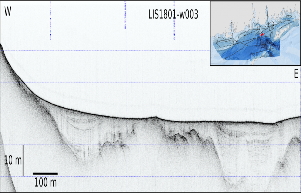
Subbottom seismic data provide information on the spatial variation of geological processes, such as deposition and erosion, as well as insights into ongoing processes and the physical evolution of the benthic environment. They are collected as continuous profiles and show the changes of sediments with depth over a distance. The purpose of these subbottom data is to guide subsequent sediment coring to obtain good penetration and recovery of sediments and to place results from the sediment core analysis into a wider spatial and temporal context.
The core and seismic data collected by the LIS Seafloor Habitat Mapping Initiative’s LDEO team can be accessed through the Long Island Sound Data Navigator and the LDEO Long Island Sound Program page.