One of the hallmarks of the initial development of the Long Island Sound Seafloor Habitat Mapping Initiative was the recognition that to develop truly useful map products the entirety of the complex ecosystem of the Sound had to be sampled, observed and mapped. The four fundamental elements provide comprehensive data that can be merged through the power of geographic information systems (GIS) to provide map products essential for marine spatial planning.
To collect this data requires a range of technologies to address the many inherent challenges of studying the ocean. Further, the comprehensive information needed to manage Long Island Sound and its resources must be gathered at a range of scales – from the large features of the underwater landscape to the fine scale distribution of organisms living on and in the seafloor. Therefore the technologies being utilized by the Long Island Sound Seafloor Habitat Mapping Initiative’s teams of scientists rely upon a diversity of approaches – acoustic systems, physical sampling tools, imaging technologies and predictive models.
Acoustics
Acoustical characterization includes bathymetry & backscatter and derived map products

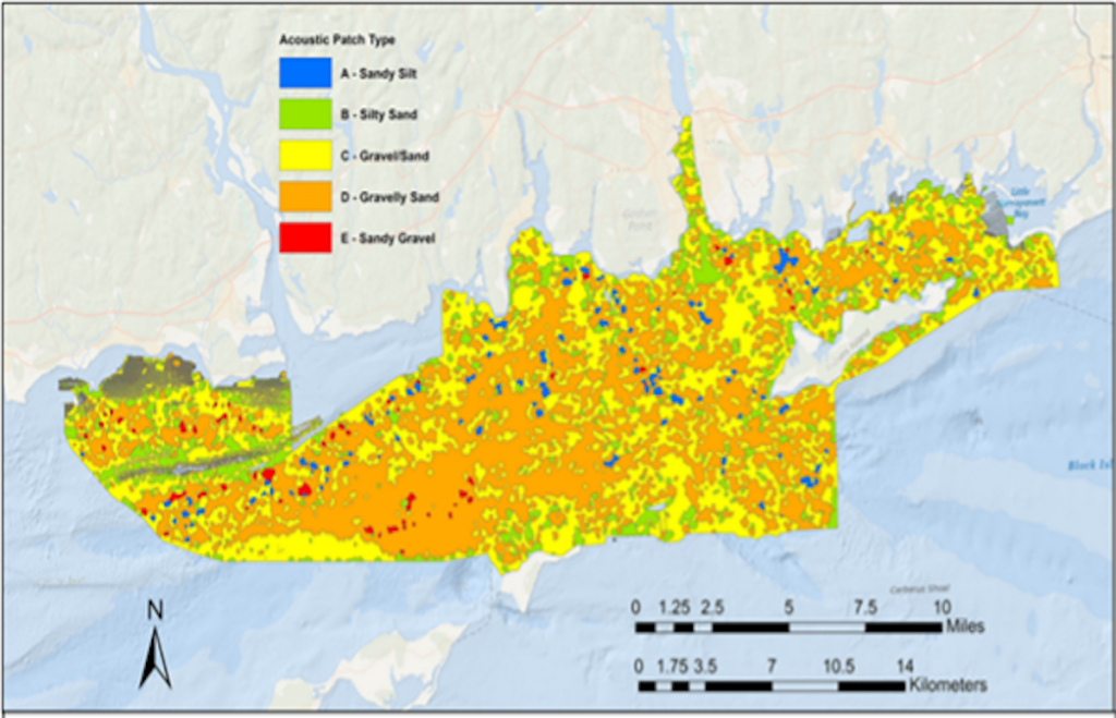
Sediments
Sediment characterization comprises grain size measurements and larger sedimentary environments
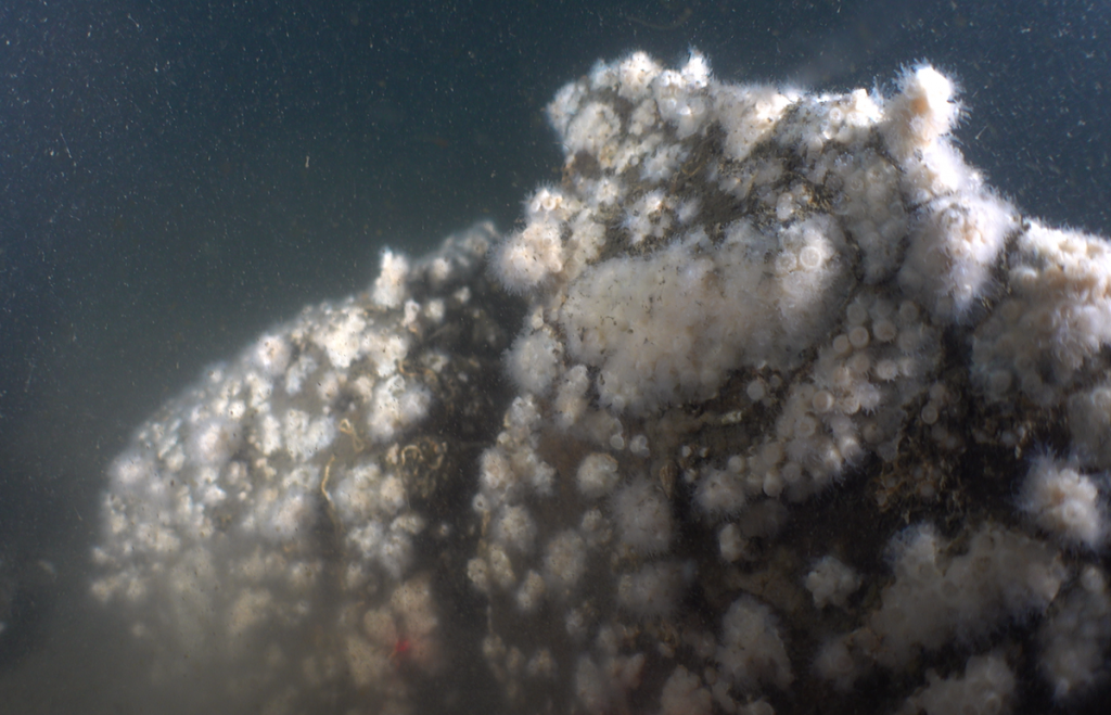
Ecology
Ecological characterization includes data from infaunal and epifaunal sampling and integrated map products
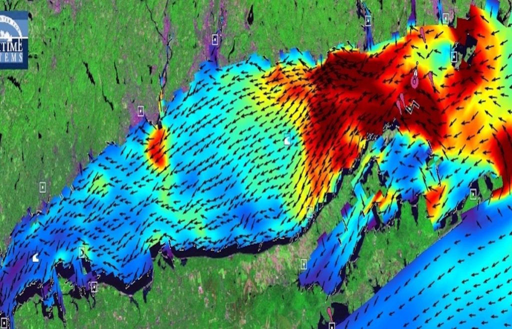
Physical Oceanography
Physical oceanography presents data on currents, temperature, salinity and model outputs